 Myrabella / Wikimedia Commons, CC BY-SA 3.0
- Established Peer-reviewed or mainstream consensus: the claim is as settled as archaeology gets.
- Suggestive Plausible and evidence-backed, but limited, evolving, or not yet mainstream.
- Contested Disputed among researchers, or popular-press overreach of what the evidence actually shows.
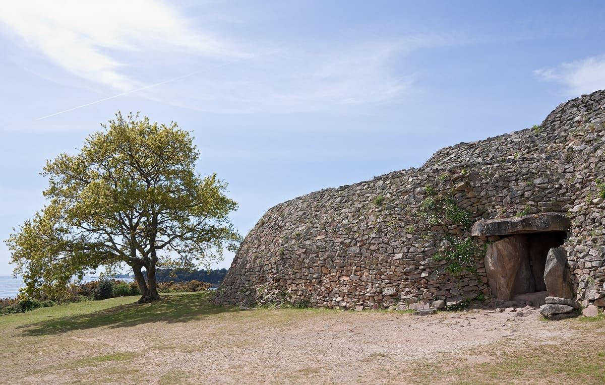
In the Gulf of Morbihan in Brittany, reachable only by boat across a fast tidal channel, sits a small island with a stone cairn at its heart. Inside, a passage runs into the dark, and nearly every slab that lines it is carved from edge to edge with arcs, waves, spirals and concentric loops. Built in the centuries around 3500 BCE, Gavrinis is the most richly decorated megalithic monument in all of Europe.
The dates and the place
The interior of the Gavrinis cairn was constructed and in active use within a bracket that primary radiocarbon dating places in the late fifth and early fourth millennium BCE. Established It sits on a small island in the tidal Gulf of Morbihan, a body of water scattered with islands, a number of which also carry megalithic monuments. The cairn itself is a long passage grave: a stone-lined corridor leading to a terminal chamber, covered by a mound of earth and rubble roughly fifty metres across.
Cassen et al. (2014), "The first radiocarbon dates for the construction and use of the interior of the monument at Gavrinis," PAST 77 – Academia.edu.
Carving with no gaps
Most prehistoric monuments are sparing with their marks. Gavrinis is the opposite. The builders covered almost every surface inside the passage, slab after slab, in dense, deliberate patterns that flow across the stone. Established Arcs upon arcs, spirals, concentric loops, axe-like shapes and wave patterns fill the walls from base to ceiling. The 3D lasergrammetric and photographic survey published by Cassen and colleagues has mapped these engravings in meticulous detail, and what the record shows is not haphazard decoration: the composition is consistent and considered.
Cassen et al. (2014), lasergrammetric recording of the engravings – ResearchGate.
Generations of scholars have proposed readings: axes, shields, water, fingerprints of some forgotten cosmology. None of them has achieved consensus. The one thing nobody argues is that it meant something to the people who spent lifetimes cutting it.
The same stone in three places
Here is the genuinely remarkable part. The great decorated capstone at the end of the Gavrinis passage was, before the cairn was built, a fragment of a single enormous engraved menhir. That same menhir was broken apart, and the other two main fragments were carried away and reused as capstones in two other monuments: the Table des Marchands, roughly 12 kilometres away near Locmariaquer, and Er Grah. Archaeologist Charles-Tanguy Le Roux was the first to identify this, showing that the engravings match across the breaks between monuments now separated by kilometres of landscape. Established
French Ministry of Culture (Mégalithes de Morbihan), "Large stele at Table-des-Marchands and Gavrinis" – archeologie.culture.gouv.fr; Le Roux identification summarised in Locmariaquer megaliths entry – Wikipedia (citing Le Roux).
Why the stone was broken and its pieces distributed across separate monuments is not known. The original menhir was probably around fourteen metres tall and would have stood as one of the largest single carved stones in prehistoric Brittany. Whoever broke it chose to keep the carved pieces in use, not to destroy or discard them, but to scatter them deliberately, embedding fragments of a single object into monuments that are geographically separate but archaeologically connected. It is one of the most striking acts of intentional material reuse in all of European prehistory.
What the engravings mean
The honest answer is: we do not know. The arcs, spirals and axe forms appear in other Breton megalithic contexts, suggesting they were part of a shared visual vocabulary across the region. Suggestive But without any written record or direct parallel that decodes the symbols, interpretation remains open. Some researchers have connected the concentric arc patterns to water or celestial motion; others treat the axe shapes as prestige objects rendered in stone. The acoustic dimension occasionally comes up in popular writing, but there is no peer-reviewed acoustics study of Gavrinis and no basis for claims about deliberate sonic design. Contested The engravings are real; their meaning is genuinely unresolved.
Where the real places end and the story begins
Everything above is on the record. The cairn, the wall-to-wall carving, the shared broken menhir are documented, dated and in the published literature.
Michael and Evelyn find something here that starts their journey, very early in the book. The novel imagines what it would mean if the impulse to mark, to distribute, to leave a pattern across multiple separate places was not decoration but instruction. The carved passage is real. The broken stone in three cairns is real. What the fiction asks is the question the archaeology invites: why did someone go to such extraordinary trouble?
Continue the trail
Get the complete Real Places field notes as a PDF now, plus each new site as it drops
All eight sites in one PDF: the full archaeology, the evidence tiers, the open questions. Yours the moment you join, then each new site as the series continues.
Never shared. Leave any time.Next site on the trail
Newgrange
53.6947° N, 6.4756° W · Boyne Valley, Ireland
Stolen Genesis: Legacy Denied is Book One of the Stolen Genesis series. The locations are real.