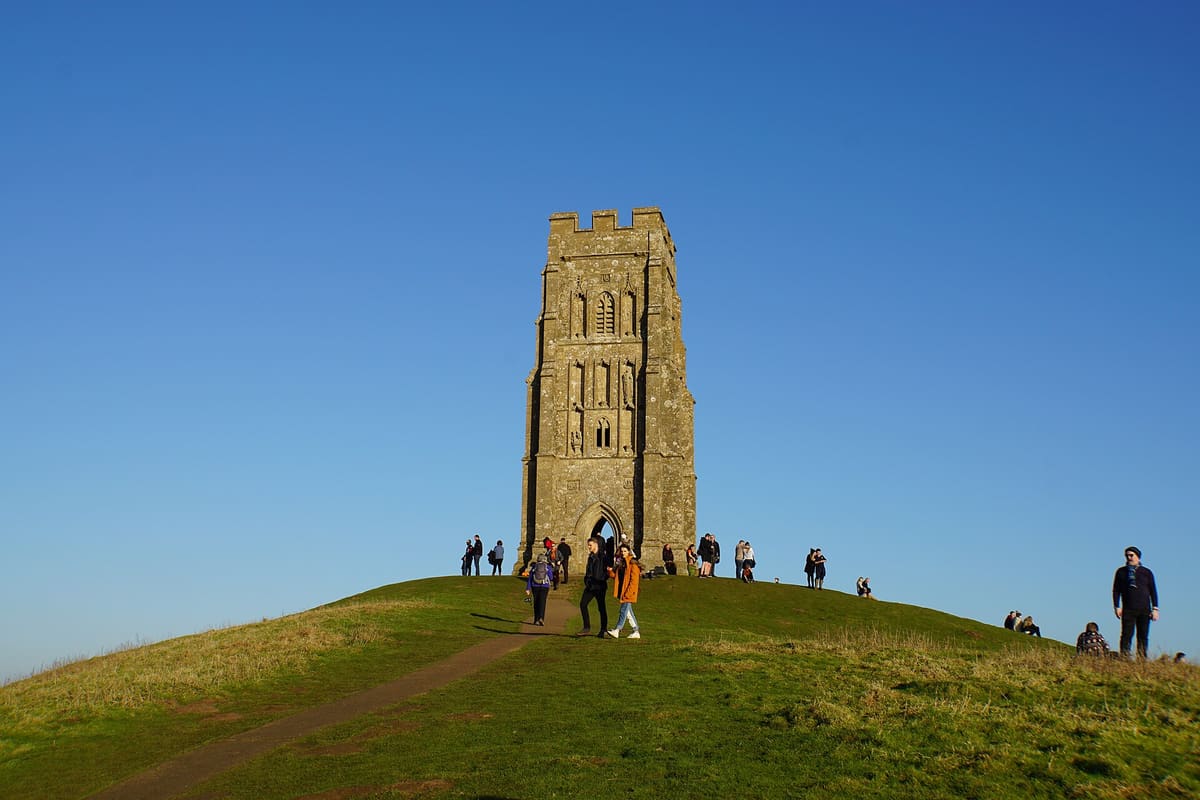
 Bill Boaden / Wikimedia Commons, CC BY-SA 2.0
- Established Peer-reviewed or mainstream consensus: the claim is as settled as archaeology gets.
- Suggestive Plausible and evidence-backed, but limited, evolving, or not yet mainstream.
- Contested Disputed among researchers, or popular-press overreach of what the evidence actually shows.
Rising out of the flat Somerset Levels, visible for miles across a landscape that was once wetland and estuary, Glastonbury Tor is the kind of hill that looks deliberate. It is crowned by the roofless tower of St Michael, and its slopes are wrapped in a series of terraces that spiral around the hill from base to summit. People have been climbing it to look for something for as long as anyone can remember, and the archaeology suggests they have always found reasons to keep coming.
What the excavations actually found
Philip Rahtz’s excavations of the Tor in 1964–66 revealed occupation during the Dark Ages, in the fifth to seventh centuries CE. The finds were significant: the remains of timber buildings, evidence of a metalworker’s forge, human burials, and imported Mediterranean amphorae from the sixth century. Established The pottery type identifies trade connections with the eastern Mediterranean at a period when that kind of long-distance commerce was rare and meaningful. Someone at the top of this hill was receiving goods from thousands of miles away in the early medieval period.
Rahtz (1970), "Excavations on Glastonbury Tor, Somerset, 1964–6," Archaeological Journal 127 – Taylor & Francis; National Trust – nationaltrust.org.uk.
The terraces: labyrinth or agriculture?
The Tor’s most visually striking feature, the series of terraces that wrap its slopes, has prompted a long-running and genuinely unresolved debate. One reading, proposed by Geoffrey Russell in 1968 and taken seriously in some quarters, is that the terraces form a three-dimensional spiral labyrinth, a path to be walked in a particular sequence as a devotional or ritual act. Suggestive
The more prosaic mainstream reading is that they are medieval agricultural lynchets, the result of strip cultivation on sloping ground. Historian Ronald Hutton has argued for this functional interpretation, noting that similar terracing appears on many English hillsides with no ritual association. Contested The terraces are real and their purpose remains genuinely debated. The National Trust manages them as historic landscape features without committing to either reading.
Avalon, Arthur, and the deliberate myth
Since the Middle Ages, the Tor has been identified with Avalon, the otherworldly isle of the Arthurian tradition. In 1191 the monks of Glastonbury Abbey announced the discovery of Arthur and Guinevere’s grave in their grounds, complete with a lead cross inscribed with Arthur’s name. Contested The timing is telling: the discovery came shortly after a catastrophic fire destroyed the abbey in 1184, at a moment when pilgrimage income was desperately needed. Modern scholarship, including a major archaeological project at Reading University, reads the “discovery” as a fundraising fabrication rather than a genuine find. The cross has since disappeared.
Gilchrist & Green (2015), Glastonbury Abbey: Archaeological Investigations 1904–79, Society of Antiquaries – University of Reading; Arthurian myth analysis – Reading Glastonbury Abbey project.
What is not contested is the depth of the tradition. The Avalon identification, whether fabricated or built on something older, has drawn pilgrims, seekers and the curious to this hill for centuries. The Tor has a quality that is difficult to explain away: something about it keeps pulling people up the slope.
The geological quirk at the foot of the hill
At the foot of the Tor, the Chalice Well runs red with iron-rich water, while a nearby spring runs white with calcite. This is a genuine geological feature, two springs of chemically different water emerging close together, that has drawn pilgrims for centuries. Established Whether the red water gave rise to Grail associations or whether Grail associations drew attention to the red water is, appropriately, uncertain.
Where the real places end and the story begins
The tower, the terraces, the Dark Age forge, the imported Mediterranean pottery, the Avalon tradition: all real, all on the record, all waiting for you at the top of a hill you can walk up today.
The Tor is a place that gathers reverence. People have treated it as somewhere that matters for well over a thousand years, across many different belief systems and purposes, and the novel respects and extends that long gravity. What the characters encounter there, what draws them to the summit, belongs to the fiction. The pull of the place itself is not invented.
Continue the trail
Get the complete Real Places field notes as a PDF now, plus each new site as it drops
All eight sites in one PDF: the full archaeology, the evidence tiers, the open questions. Yours the moment you join, then each new site as the series continues.
Never shared. Leave any time.Next site on the trail
The Richat Structure
21.1236° N, 11.4006° W · Adrar Plateau, Mauritania
Stolen Genesis: Legacy Denied is Book One of the Stolen Genesis series. The locations are real.